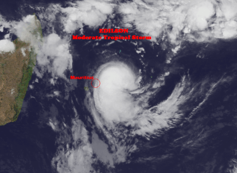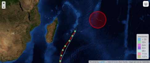
Link to real time EDILSON Satellite Loop
http://tropic.ssec.wisc.edu/real-time/indian/storm/movies/MOV8-4.13S.GIF
Current Wind Speed: 40 knots / MPH
Max Predicted Wind Speed 60 knots / 69 MPH
Mauritius : A cyclone warning Class 3 is still in force in Mauritius.
Reunion island: Cloudy weather associated with strong winds from the south. Moderate Tropical Storm Edilson 990 hPa was located at 4 425 km North-East of the island pursuing a South-West trajectory at 22 km / h.
EDILSON is gradually shifting its structure towards a move typical warm core system. However due to a moderate northerly to north-westerly constraint ( 12 knot according to CIMMS analysis at 00Z ) The surface centre appear displaced to the north of the convective area. Long range radar imagery from Reunion island suggest that a mid-level circulation exist within the convective area that is displaced to the south of the surface centre. The current intensity estimates, based on DVORAK, is on the very good agreement with all other available estimates (KNES AND PGTW AT 3.0 AT 2330Z). Under the steering influence of a northerly to north-easterly flow, Edilson is now accelerating on a south south-westwards track and this motion is expected to continue during the next 48 hours. Available guidances remain in good agreement.
The sheared conditions should maintain today and should not allow the system to deepen further at short range. However, if the current mid-level circulation becomes more vertically aligned with the surface centre, a stronger rate of intensification than currently indicated is possible during the next 24 hours. Edilson is expected to maintain an asymmetric circulation with strongest winds and heavy rains mainly located within the south-eastern semi-circle. South of 20S, the northerly shear is expected to increase. Friday and Saturday, NWP guidances also suggest positive interaction with the upper level dynamics associated with the mid-latitude trough that should persist to the south-east of Madagascar. This interaction may maintain or slightly increase the intensity of the system that will evolve to a post-tropical structure.
In regard of to the expected track, the inhabitants of the Mascarene islands, particularly Mauritius should monitor the progress of the system. Radar imagery from Reunion show some heavy rain bands just a few miles off the eastern coast of Mauritius.
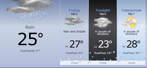
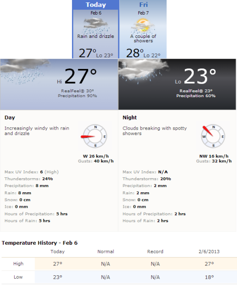
Mauritius 06.02.14, 24 hours cursory weather forecast.


Pingback: NetNewsledger.com - Tropical Cyclone Edilson Heavy Rainfall Recorded